Army Corps of Engineers Alters Downstream Dam Releases in Montana After Heavy Rainfall
After recent heavy rainfall in Montana, the Army Corps of Engineers has had to alter downstream dam releases.
The northeast corner of the state has received more than 600% of normal rainfall over the past two weeks, according to KPVI News. National Weather Service data shows that in the first two weeks of this month, rainfall brought between 200% and 600% of normal rainfall over the whole Missouri River Basin. The National Weather Service issued numerous river flood alerts and warnings.
Over the course of one week, the Milk River at the Nashua gauging station increased from a flow of nearly 200 cu ft per second to 3,000 cu ft per second as of Sept. 13. Over at the Missouri River above Fort Peck Reservoir, water rose from 7,000 cu ft per second to 8,000, or about a half-foot rise, KPVI news reported. Additionally, the Yellowstone River rose from less than 7,000 cu ft per second to 12,700.
Inflows from the Missouri River to Lake Francis Case in South Dakota were marked at 116,00 cu ft per second. This reservoir is the 11th largest in the United States and rose 2 ft in two days because of the runoff, according to KPVI News.
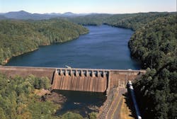
Over the weekend, the Corps decreased releases from Gavins Point Dam in South Dakota by a total of 10,000 cu ft per second. They started with a 5,000 cu ft per second decrease on Saturday and reduced an addition 5,000 on Sunday.
John Remus, chief of the Corps’ Missouri River Basin Water Management Division, said to KPVI News that the Corps reduced the releases in attempting to reduce the chances of flood water reaching Interstate 29 north of Omaha.
Releases at 60,000 cu ft per second from Gavins Point Dam were to last no longer than three days. After the three days, the flows will be decreased by 5,000 cu ft per second a day, up to 80,000. According to KPVI News, the goal of the increased releases is to ensure that the 16.3 MAF of designated flood control storage will be available prior to the 2020 runoff season.
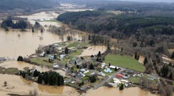
Due to a wet spring and heavy runoff, downstream states along the Missouri River have been prone to flooding this year.
As of Sept. 13, runoff in the upper Missouri River Basin was 49.9 MAF, which is higher than the 1997 runoff of 49 million acre feet. This makes 2019 the second highest runoff in the 121 year record, KPVI News reported. The projected 2019 runoff is 58.8 MAF.
Read related articles to rainfall and flooding.


