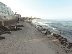
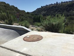
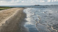
Dry-weather runoff, or non-stormwater discharge, is flow that enters the municipal separate storm sewer system (MS4) from a combination of activities including lawn watering, over-irrigation, car washing, illegal discharges, and groundwater seepage. These flows, often called “urban drool,” pose an environmental threat due in large part to the trash, sediment, and pollutants they transport through the MS4 and into receiving waterbodies. Existing regulations require the City of San Diego, CA, to effectively prohibit non-stormwater discharges through its MS4 and implement controls to reduce the discharge of pollutants to the maximum extent practicable.
Flow monitoring can be used to characterize the non-stormwater discharges, to identify temporal patterns, and to measure the effectiveness of control measures aimed to reduce and eliminate nuisance flows. However, flow data reports are often only available for analysis months after being collected, well beyond the window of opportunity when the data are most useful to make timely and effective corrective actions.
“Non-stormwater discharges are transient in nature and often do not coincide with scheduled site visits and field investigations,” says Heather Krish, stormwater environmental specialist for the City’s Storm Water Division. As such, the City has embarked on an innovative monitoring approach in an effort to transform data by making it available in near real time.
With access to flow data and useful statistics in near real time through a customized web portal, the city Storm Water staff and field investigators are using the portal as a hub of data interaction and collaboration to determine when significant flows are occurring and schedule when follow-up investigations may be necessary. The constant access to the information and greater understanding of when and where non-stormwater discharges are occurring is guiding management actions to eliminate non-stormwater discharges with far more efficiency in staff resources than ever before, thus reducing costs while collecting more accurate and beneficial data.
Background
With spectacular weather most of the year, miles of beautiful beaches, and an abundance of bays, lagoons, and lakes, San Diego has unlimited aquatic recreational opportunities for residents and tourists to enjoy from the mountains to the Pacific Ocean. The City’s Storm Water Division has a very important goal: to preserve and protect the water quality and the beneficial uses of these aquatic attractions.
Pursuant to the federal Clean Water Act, the National Pollutant Discharge Elimination System (NPDES) programs administered by state and local regulators require the City to meet stringent water-quality standards to protect the habitat, ecology, and overall health of local water bodies. This includes ensuring that all beneficial uses are protected. As previously noted, these regulations require the City to effectively prohibit non-stormwater discharges through their MS4 and implement controls to reduce the discharge of pollutants to the maximum extent practicable.
The City’s dry-weather monitoring program is used to establish baseline flow conditions, to measure the effectiveness of strategies implemented toward reducing or eliminating dry-weather flows, and to estimate pollutant loads. The Monitoring group within the Storm Water Division consists of only five biologists and one stormwater environmental specialist; yet, for the City’s dry-weather monitoring program alone, they perform numerous activities. The group monitors more than 500 major MS4 outfalls annually, performs in-depth chemical analysis and investigations of 30 of the highest-priority major MS4 outfalls twice per year, implements a sampling program to accurately assess flows, and investigates hundreds of illicit non-stormwater discharges each year. Additionally, City code enforcement officers initiate corrective or enforcement actions.
Accurately characterizing the quantity and quality of dry-weather runoff over time is a very important component of the City’s dry-weather monitoring program. The accuracy has a direct correlation to the City’s ability to assess impacts to receiving water quality and determine the effectiveness of the City’s corrective actions and best management practices (BMPs), including structural BMPs (e.g., low-flow diversions) and non-structural BMPs (e.g., public education).
Development of the MS4 Flow System
“When we created the MS4 Flow System, we wanted to implement a data collection and management system that allows our clients to efficiently identify, reduce, and eliminate dry-weather flows,” says Dave Renfrew, vice president at Alta Environmental. “We also wanted the units to be simple and low-cost for municipalities to deploy them on a larger scale.”
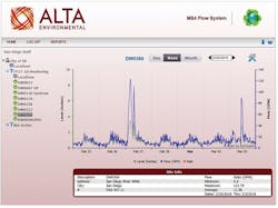
MS4 Flow System web portal site summary page with weekly hydrograph and statistics
With limited staff and resources, municipalities are required to effectively prohibit non-stormwater discharges through their MS4s, implement controls to reduce the discharge of pollutants to the maximum extent practicable, and measure the strategy effectiveness. All San Diego municipalities are required to visit their highest-priority outfalls twice during each monitoring year to assess flow status, sources, and pollutant concentrations.
However, conducting randomly scheduled field inspections can have limited success in eliminating transient discharges. Relying solely on instantaneous estimates of flow could result in incomplete or biased estimates of baseline flows and hinders efforts to assess trends and reductions over time. “Alta saw the need to design a tool that could accurately assess dry-weather flow and transform it into real-time interactive information the municipalities could use to maximize the extensive monitoring effort,” says Renfrew.
Alta teamed up with a local San Diego company, Utility Systems Science and Software, which builds metering equipment commonly used in the wastewater industry, largely to prevent sanitary sewer overflows. “We are using a web-enabled flow data system that relies on ultrasonic sensors and wireless data logs, and we worked closely with the City to develop a web portal specifically designed to track dry-weather flows,” says Renfrew.
The MS4 Flow System utilizes a low-cost flowmeter housed in a waterproof case connected to an ultrasonic sensor that provides precision non-contact depth measurements. The flowmeter is typically set to record at 5- or 15-minute data intervals, has a one-year lithium-ion battery lifespan, requires minimal maintenance, and is easy to install. Once sites are sufficiently characterized and flows recorded, the instruments can be moved to new locations, providing scalability with only a few instruments. In addition, the units have proven to be less prone to vandalism and theft than other larger, more visible flowmeters in the urban environment. The preferred installation location is within the MS4 at a manhole vault, with nothing more than an antenna resembling a white road marker attached to the top of a manhole lid.
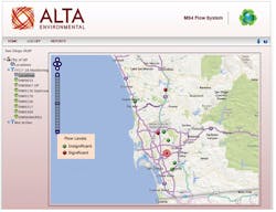
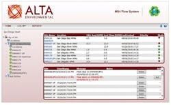
The flowmeter sends the data to a customizable web portal, where it is organized and displayed to create a hub of data interaction, interpretation, and collaboration. The web portal can initiate flow-based alarms and generate site-specific reports to evaluate flows on a daily, weekly, or monthly basis. Based on site-specific criteria, the user can enter a flow threshold that the portal uses to determine whether the flow status icon is insignificant (green) or significant (red). The red or green status icon is displayed on a map to help users identify flow status and quickly prioritizes which monitoring locations require more focus and determine where to dive deeper into the data.
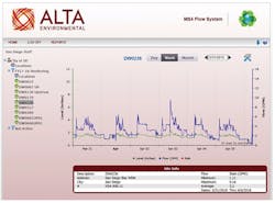
The main page for each monitoring location includes a hydrograph of level, flow, and rainfall data that allows users to easily review in daily, weekly, or monthly views. Below the hydrograph is a simple table of flow statistics of the date range being graphed. The hydrographs, tabular data, and statistics summary tables can be created for an individual monitoring location or a grouping of monitoring locations and are easily exported to Excel, Word, or Adobe programs.
The City’s Project
As part of an ongoing project, Alta Environmental and teaming partner Wood PLC have worked with the City to use the MS4 Flow System in more than 65 deployments over the last three years. In 2015, the City conducted a pilot study that demonstrated how the flowmeters could provide reliable and accurate estimates of flow. The pilot study also demonstrated that the ability to access the near-real-time data through a customized web portal could be a very useful tool in the City’s efforts to eliminate non-stormwater discharges.
Based on the success of the initial pilot study, the MS4 Flow System was deployed at numerous locations throughout the City during the following monitoring year to aid in assessing flow conditions and evaluating flow patterns at specific MS4 outfall sites of interest to the City.
“Tracking monthly flow rates for consistency patterns and reviewing daily flow rates for specific times in flow spikes helps indicate anthropogenic inputs. I think the meters are a great tool to help our investigations and obtain much more accurate flow rates for reporting purposes,” says Arielle Beaulieu, biologist with the City’s Storm Water Division.
During the current 2018 monitoring year, the City continued to expand the project and deployed meters at nearly all 30 of the highest-priority major MS4 outfalls. The City has been deploying flow data systems throughout their MS4 network to collect accurate measurements of real-time flow rates and trends to establish baseline flow conditions, measure the effectiveness of strategies implemented toward reducing or eliminating dry-weather flows, and estimate pollutant load reductions.
Accurate Flow and Baseline Measurements
The ability to accurately estimate flow rates and establish baseline flow conditions is paramount for the City. The ability to manually estimate flow in the field is dependent on the accessibility of a given location. In the urban MS4 environment, this often requires time-consuming and dangerous, confined-space entry.
Therefore, visual estimates of flow were generally conducted only from street level for many of the MS4 monitoring locations, anywhere from 5 to 40 feet above flow at the bottom of the MS4 pipes. This potentially causes higher variability in flow assessments based on the ability of staff to accurately estimate the flow conditions.
“With over 500 major outfalls to monitor each year, performing confined space entries on even half of them would dramatically increase our cost and time requirements to be in compliance with our NPDES permit,” says Krish.
In areas where non-stormwater discharges are diverted to the sanitary sewer at low flow diversions, the Storm Water Division is charged per gallon of water entering the sanitary sewer system. Any inaccuracies in flow measurements could have hefty financial impacts. At one location, the City was calculating flow based on instantaneous visual assessments of curb sheet flow prior to entry into the MS4 system to avoid complications and errors inherently involved with estimating flow deep within the pipe. After numerous site visits, these data were averaged together to estimate baseline flow, which was then used to calculate cost for diverting dry-weather flows to the sewer.
To test the accuracy of the visual assessments, the MS4 Flow System was installed in the MS4 conveyance, just upstream of the sewer diversion and downstream of the curb where the flow was historically assessed. As suspected, even when using measuring devices to measure curb sheet flow, the visual assessments were overestimating flow rates and resulting in inflated baseline flow estimations.
“We suspected that these calculations were overestimating our baseline flows because they were not designed with the inconsistencies in shape and uneven surfaces of curbs in mind,” says Krish.
The MS4 Flow System verified that the baseline flow rate was less than half of the original estimates based on visual assessments, for two main reasons. One, the MS4 Flow System took measurements every 15 minutes for an entire year, resulting in greater temporal coverage of the flow than was provided by sporadic site visits, while evening out spikes in flow rates that could have been unknowingly observed during site visits. Second, the MS4 Flow System does not create water disturbance while taking depth measurements and therefore eliminates even the slightest overestimations of depth. Having an accurate and defensible baseline flow saved the City unnecessary expenses by proving that the baseline flow was only half of what it was thought to be, cutting the cost to the Division by approximately 50%.
Flow Patterns and Investigations
“Without continuous data, chasing down illicit discharges can feel a bit like playing the game Whack-A-Mole because you never know when and where a discharge will pop up. To coordinate investigations to coincide with discharges can certainly be a guessing game,” says Krish.
Recurring spikes of non-stormwater discharges during the night or early morning hours are commonly due to irrigation runoff, whereas erratic spikes may be due to a variety of intermittent sources such as pools, pumps, washing, or dumping activities.
“We were experiencing wild variations in observed flows at one of our high-priority major MS4 outfall locations. The biologists were finding different sources of illicit discharges during each visit, but nothing that could account for the totality of the flow. We decided that installing a flowmeter to discover temporal patterns of peak flows would be instrumental in the discovery of recurring and significant inputs into the MS4 system,” says Krish.
The City installed the MS4 Flow System and used the web portal to evaluate flow patterns to determine when significant flows were occurring. It quickly became obvious that there was a consistent baseline flow, supplemented by peak flows of temporal consistency. With this information, biologists were able to inform City Code Enforcement exactly when the surrounding area should be inspected to target those regular and pronounced peaks of nuisance flow.
“Having this information allowed us to effectively allocate our limited resources and eliminate several illicit discharges,” says Derek Marsden, code enforcement supervisor for the City’s Storm Water Division. Numerous discharges were identified and the average baseline flow was reduced by 40%.
Flow monitoring continued for several weeks at this site after the illicit discharges were addressed to confirm that the City’s efforts were effective. During that time, a water main break occurred in the drainage area of the outfall. Because of the near-real-time transmittal of flow data, the City was able to see that flow volumes were spiking and was able to initiate an immediate investigation revealing the break. Crews were notified immediately as a result of the MS4 Flow System, and the exact time of the break was recorded along with an accurate estimation of the potential volume caused by the break. Finding and fixing unexpected situations like this are time critical and can potentially prevent serious and dangerous situations from occurring, protecting the public from sinkholes and saving the City from costly repairs.
telemetry resembling a white road marker attached to the top of a manhole lid
Unknown Inputs Into the MS4
With such close proximity to beaches and the ocean, discharges of bacteria are of serious concern and a top priority for the City’s Storm Water Division. So, when an illicit discharge containing high levels of bacteria became known, the City began an immediate investigation and was able to isolate the source to a segment of pipe located between two manhole access points. Baseline flows in each manhole were similar according to visual assessments (each estimated at approximately 1.5 gallons per minute), yet the bacteria concentrations in the downstream manhole were elevated while the upstream flow was clean. In an effort to obtain more data, the City had the MS4 Flow System installed at both sites.
The equipment was successful at accurately measuring differences in flow between the upstream and downstream monitoring locations, and quickly revealed slightly higher average base flows (approximately 0.5 gallons per minute) at the downstream location with additional intermittent peaks of flow. This suggested either an unmapped connection or unknown infiltration in the pipe segment connecting the manhole access points.
A confined space entry investigation revealed an illicit connection feeding a low flow sewage discharge with high bacteria levels from a private property, which City code officers were then able to address and correct. “The accurate flow measurements provided by the meters assisted us in confirming that an illicit connection existed in the segment of pipe in question and gave us the data we needed to justify a confined space investigation, resulting in the rapid cessation of a polluting discharge,” says Krish. In cases like these, the smallest differences in baseline flows, which would otherwise be very difficult to detect with visual assessments, can provide that extra bit of data needed to fully understand what is going on in a conveyance system.
Flexible and Adaptive
Based on feedback from the City, the MS4 Flow System web portal is continually customized to improve the features that aid in assessing flow conditions and evaluating flow patterns. One key upgrade was to ensure that all peaks and troughs of flow, including very flashy discharges, are clearly visible when reviewing the monthly hydrographs. Alta Environmental is currently working on making data more visually comparable to previous years for long-term historical comparisons by displaying current and historical data graphs in side-by-side configurations. Moving forward, an additional function will be added to the web portal to allow users to highlight flow anomalies that occur during targeted time windows and allow the City to focus in on key hours of the day for targeting field investigations.
“The Storm Water Division will continue to explore how new technologies can be used to protect and improve water quality, as well as look for innovative ways to use current technologies in non-standard ways,” says Andre Sonksen, stormwater compliance manager, City Storm Water Division.
The City is also exploring the use of the MS4 Flow System in other applications beyond dry-weather flows, including additional support of code compliance issues, indirectly monitoring the effects of Notices of Violation, early detection monitoring for beach outfalls to identify flows at popular surfing beaches via public access applications, and/or using the meters to track rainfall effects in the MS4.
Conclusion“This technology has enabled us to monitor flows that we were previously unable to monitor. With this, we are able to target our staff to locations and times when these discharges are happening,” says Sonksen. “This increased efficiency has only been possible by improved sensors technology an innovative use of this technology. We have been able to be more efficient and effective in preventing non-stormwater discharge.” The City’s MS4 monitoring has shown that real-time flow data collection, interpretation, and collaboration increases the likelihood that flow data are used effectively to implement action and positive change. This approach demonstrates how bridging the gap between field investigations and decision-makers through online collaboration brings out the true potential of the data.
Garth Engelhorn is with ALTA Environmental, a water resources management consulting firm.
Heather Krish is a biological technician with the City of San Diego.

