Three USGS streamgages recognized as centennial observing stations
The U.S. Geological Survey (USGS) announced that, this year, the World Meteorological Organization (WMO) recognized the cultural and scientific relevance of three USGS-operated streamgages as “centennial observing stations.”
The streamgages are located in Oregon, Kentucky and New Mexico.
The formal designation by WMO recognizes the valuable contributions of these three USGS streamgages, which have been in operation for more than 100 years. The intent is to showcase the valuable contributions made by long-term streamgages to scientific understanding about connections between long-term weather and environmental trends and patterns, including floods and droughts.
The designation is part of WMO’s international recognition program, which now includes hydrological stations for the first time.
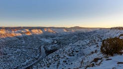
The three USGS centennial streamgages comprise half the recognized locations in North America and are among the first 22 WMO centennial streamgages worldwide. The newly recognized gages are located on the Columbia River at The Dalles, Oregon, the Ohio River at Louisville, Kentucky, and the Rio Grande at Embudo, New Mexico. Notably, the streamgage on the Rio Grande at Embudo, New Mexico was USGS’s inaugural streamgage, established in 1889.
The three streamgages recognized by the WMO designation are not the only USGS streamgages of cultural and scientific significance to long-term earth observations. The USGS also has its own Centennial Streamgage program to recognize those that have been in use for at least 100 years. These streamgages tell the story of the water conditions they measure over the past century and are essential to understanding the climate system and its changes. As of 2023, USGS operates 848 active streamgages that were established over 100 years ago.
A streamgage is a mechanism that measures water levels and flows in rivers and streams. The observational data gathered from the streamgages can be used to monitor droughts and floods, track water supply, and project future streamflows. USGS provides near real-time data of its streamgages through the USGS National Water Dashboard.


