Nebraska celebrates 50 years of its Natural Resources Districts
Nebraska’s Natural Resources Districts celebrate 50 years in 2022. Even after a half century of protecting the state’s precious water and soil, many Nebraskans are unaware of the important work performed by Nebraska’s NRDs.
As the home of nearly 80,000 river miles, Arbor Day, the largest congregation of cranes on earth, the deepest part of the Ogallala Aquifer, the Pine Ridge, and the one-of-a-kind Sandhills region, it’s no wonder that Nebraskans have long been leaders in conservation. With these natural jewels and many others in a state known as one of the most agriculturally productive areas in the world, conservation of natural resources is paramount.
By 1969, 154 special-purpose entities were working statewide on soil and water conservation, protecting watersheds, drainages, and other natural resources.
Changing Times
Within weeks, Congress passed legislation to address the stark situation and the Soil Conservation Service was born.
In 1949, Nebraska became the first state west of the Mississippi River to merge all its counties into Soil Conservation Districts — the predecessors of today’s NRD system.
The mission of the Soil Conservation Districts soon changed. The agency evolved into the Soil and Water Conservation Committee in 1951, and in 1969 it became the Soil and Water Conservation Commission. Three years later it changed into the Nebraska Natural Resources Commission, before joining the Department of Water Resources to form the Nebraska Department of Natural Resources.
In the late 1960s, Warren Fairchild — then the executive secretary of Nebraska’s Soil and Water Commission — joined forces with Nebraska State Senator Maurice Kremer of Aurora to research the possible merger of Nebraska’s special-purpose entities and their more than 500 districts. Meanwhile, the development of center pivot irrigation raised concern for the Ogallala Aquifer.
A small bloc of soil and water conservation districts opposed creation of the NRD system. Court challenges questioning the constitutionality of the NRD law continued until 1974 when the Nebraska Supreme Court ruled and upheld the legislation. Nebraska’s 24 NRDs dropped in number to 23 when the Middle Missouri Tributaries NRD and Papio NRD merged to form the Papio-Missouri River NRD in 1989.
Educating Future Conservationists
Whether knee deep in a muddy marsh teaching elementary school students why wildlife needs clean water or helping with land judging and range judging competitions, the professionals of each NRD’s Information and Education department know that ecosystems benefit when youngsters learn about conservation early in life.
Nebraska’s NRDs are partners and sponsors of Envirothon, North America’s largest environmental education competition. Participants learn about soil and land use, aquatic ecology, wildlife, environmental issues, and forestry.
ACE Camp (Adventure Camp About the Environment) is a four-day outdoor experience that teaches students in sixth through eighth grades about aquatics, forestry, range, grassland, wildlife, soil, and the land — and how to protect them. The camp is equal parts learning and fun. Exciting hands-on activities include ziplining, river float trips, games, and campfires. Nebraska’s NRDs offer scholarships for the event held each June at the Nebraska State 4-H Camp near Halsey.
“Conservation education helps students understand and appreciate our natural resources — and offers them information on how to conserve those resources now and for future generations,” said Larry Schultz, Information and Education Coordinator for the Lower Loup NRD. “Hands-on activities enable students of all ages to realize how natural resources affect their lives and how those resources can be used wisely.”
Working Local and Together
Subdistricts within each NRD are represented by local board members. The mission of the NRDs has grown as responsibilities assigned to them by law have increased over the last 50 years. The NRDs’ 12 areas of responsibility include flood control, soil erosion, irrigation runoff, and groundwater quality and quantity.
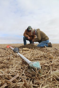
Terraces, drainage ditches and windbreaks are visible examples of the work NRDs do in cooperation with landowners. More than 100 million trees have been planted in Nebraska thanks to the NRDs’ tree planting program, a partnership with the Natural Resources Conservation Service and the Nebraska Forest Service. The organization also partners with the Nebraska Natural Resources Commission, Nebraska Department of Natural Resources, Nebraska Game and Parks Commission, and other agencies on federal, state, and local levels.
Nitrate Management
When a spike in nitrate levels caused concern in northeast Nebraska in the late 1980s, landowners weren’t left to deal with the contamination on their own.
Farmers depend on nitrogen-based fertilizers to maximize yields. When not used by crops either because too much was applied, it was applied at the wrong time, or because precipitation or excess irrigation washed it away, this nitrogen ends up in streams and aquifers. Fertilizer applied to lawns and golf courses also leaches into the water supply.
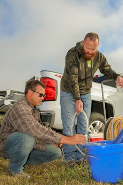
After well sampling revealed increasingly unsafe nitrate levels in sandy areas where Antelope, Knox and Pierce counties meet, the Lewis & Clark NRD, Lower Niobrara NRD, Upper Elkhorn NRD, and Lower Elkhorn NRD came together to find a solution. Ultimately, the NRDs and area landowners applied special focus to the region by forming the 756-square-mile Bazile Groundwater Management Area (BGMA), named for the nearby Bazile Creek.
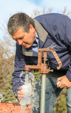
The 7,000 residents of the BGMA rely on groundwater for their drinking water. Providing safe, potable water is costly in contaminated areas. For instance, the Knox County community of Creighton had to install a $1.3 million reverse osmosis system in 1993 to filter its nitrate contaminated water. Samples showed nitrate pollution rates of 17 parts per million, well over the 10-ppm government standard for safe drinking water. That filtration system has been running ever since, largely paid for by the community’s 1,200 residents.
Working with the Nebraska Department of Environment and Energy, the Natural Resources Conservation Service, the Nebraska Environmental Trust, and other agencies, the NRDs and its stakeholders have developed a management plan for the BGMA — the first of its kind in the U.S. to address nonpoint source pollution. The nitrates issue is the result of decades of intense farming and other nitrogen use. It will take decades of hard work and cooperation to solve.
Reducing Future Flooding
NRDs came together again after a bomb cyclone in March 2019 turned out to be a perfect storm that pushed Nebraska’s rivers out of their banks. Flood control is part of the mission of all Nebraska NRDs, and all the districts in the state dealt with high water to varying degrees in 2019.
At Camp Ashland, a Nebraska National Guard training site near the community of Ashland, more than 50 buildings were inundated with up to five feet of murky water after a levy failed. Many rural residents were stranded in their homes. Power went out at the City of Lincoln’s nearby well field. Disaster declarations were issued, and Governor Pete Ricketts requested federal assistance.
When the water finally receded weeks later, some areas were covered with more than three feet of sand. So widespread was the destruction that the Lower Platte South, Lower Platte North, Papio-Missouri, Lower Elkhorn, and Central Platte NRDs, are working together to monitor river conditions to help alleviate or reduce future flooding.
Innovative Solutions from Lower Loup
In the heart of Nebraska, the Lower Loup NRD (LLNRD) stretches from the Nebraska Sandhills east to the Columbus area, spanning 156 miles west to east and including all or parts of 16 Nebraska counties. The 7,923-square-mile NRD, centrally located in Ord, occupies more than 10 percent of the land in Nebraska.
The LLNRD’s water technicians noticed water levels near Columbus falling from 2010 to 2014. Irrigation, and commercial and municipal wells, were being impacted. Residents of a sandpit lake development in Columbus weren’t happy when their lake shrunk while their sandy beachfront expanded.
The LLNRD could have used its regulatory authority to require every water user in the area to reduce their water usage. “A better option was to come up with a project to basically just move water around while allowing water users to keep doing what they are doing,” said Lower Loup NRD General Manager Russell Callan.
After passing through the Loup Power District’s hydroelectric dam, water from the tailrace can be intercepted before returning to the Loup River, when needed. A pipeline from the tailrace canal now relays water to the Lost Creek channel, which has been dry after a successful flood control project diverted flows around Columbus.
In the new recharge project, rising groundwater fills a portion of the Lost Creek channel and an adjacent shallow well, and is then pumped to the Christopher’s Cove neighborhood. Water will flow only in times of need, and the project is not dependent on the availability of excess precipitation. It can also be shut down in the event of heavy rain or snow.
The innovative project is scheduled to go online in 2022 and shows how varying interests can come together, with NRDs in the lead, to reach common goals.
“As I interact with other states and some foreign representatives, it becomes obvious that Nebraska’s NRD system, and the ability of our NRD boards to make hard decisions, is admired,” said Don Masten of Downey Drilling Inc., in Lexington. “The result of this proactive leadership is a stabilized static water level in much of the state. We’ve created a future for our children and grandchildren as a reward for making the hard decisions and changing the very framework of our ag irrigation culture.”
Nebraska’s Great Outdoors
Many Nebraskans are surprised to learn that NRDs also develop and manage fish and wildlife habitat, and parks and recreational facilities.
Outdoorsy types can explore more than 80 recreational areas, parks, trails, lakes, and wildlife management areas owned by Nebraska’s NRDs.
The NRDs build recreation areas for many reasons, often using the creation of flood control structures, wildlife habitat enhancement, soil and sediment control activities, or wetland renovation projects as opportunities to create or expand recreational opportunities for the public.
The next time Nebraskans spend a relaxing day at their local NRD’s recreation areas — or raise a glass of clear, high-quality, safe drinking water — they may want to make a toast to the next half century of Nebraska’s Natural Resources Districts. Here’s to 50 more years of conservation, education and recreation.
About the Author
Alan Bartels
Alan Bartels works with the Lower Loup, Neb. Natural Resources District as an Information Specialist.


