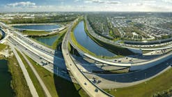
Sea Level Rise Threatens Upper Texas Coast
Source HRI
The Harte Research Institute for Gulf of Mexico Studies (HRI) at Texas A&M University-Corpus Christi has received a $790,000 grant from the Houston Endowment for a groundbreaking project to map and evaluate the effects of sea level rise on the Upper Texas Coast and develop tools to address this critical issue.
The program is the first of its kind in Texas to forecast changes to the environment caused by sea level rise and also examine the socio-economic impacts and public policy options for living with a rising sea. Since 1908, the tide gauge at Pier 21 on Galveston Island has recorded a rise in relative sea level of about 2 ft. Roughly 1 ft of this rise is due to a global increase in ocean water volume caused by climate change with the remainder caused by local land subsidence. The amount of relative sea-level rise across the greater Houston area varies because of differences in how much the land is sinking.
This phenomenon makes Houston and the surrounding areas more vulnerable to damage from hurricanes and other environmental changes. It also creates a concern for the fast-growing population in the Upper Texas coastal region who may find their homes and businesses literally at the water's edge. The study will assess the growing vulnerability of Houston and its surrounding counties to the adverse consequences of sea level rise.
HRI was selected for the undertaking because of its multi-disciplinary "Harte Model" structure that integrates the necessary science, policy and economics expertise to carry out a project of such broad scope.
Dr. Jim Gibeaut, Endowed Chair for Geospatial Sciences, will lead a team of three HRI Endowed Chairs who will assess the impacts of sea level rise on the greater Houston area to acquire the knowledge necessary to lesson and adapt to higher sea level during the next 50 to 100 years. Gibeaut will map the current environment to compile and update the best available geospatial data; Dr. David Yoskowitz, Endowed Chair for Socio-Economics, will analyze the economic impacts on the region's natural and man-made environments; and Dr. Richard McLaughlin, Endowed Chair for Marine Policy and Law, will examine current policy approaches for addressing sea level rise and the possibilities of developing new approaches.
The HRI assessment will involve projecting the geographic changes that sea level rise is expected to cause, the economic impact on the natural and built environments, and an analysis of current policies and opportunities for coastal zone management with respect to sea level rise. Results will be disseminated through a data and information-rich website that will enable policy makers, managers, and the general public to evaluate the impacts or risks of private and public land use decisions with greater precision and accuracy.
By developing and disseminating data and information for addressing the impacts of sea level rise, the project will also create opportunities for local innovation and help people make more informed investments; whether it is the purchase of an individual home or the construction of new neighborhoods, schools and business centers. By showing areas that are at risk to the negative impacts of sea level rise and estimating the environmental and socio-economic cost of that impact, project results will provide essential information for planning the conservation, protection, or restoration of coastal environments, help guide private and public land acquisitions, and identify new locations for growth and development.
Source: HRI


