ROUND UP: What’s New in Geographic Information System (GIS) Products?
When it comes to geographic information system (GIS) products, there are plenty of options available for stormwater managers to consider in capturing, storing, manipulating, analyzing, managing, and presenting all types of spatial or geographical data required for effective stormwater management.
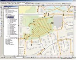
GIS software and GIS mapping software are critical to any stormwater management program, and enhance municipal systems in many ways. For example, the city of Watchung, FL has been able to streamline its stormwater operations through the use of VUEWorks Storm, an integrated GIS asset and work management software tool. Storm interfaces with VUEWorks Core to provide asset management for storm drain systems. For example, flow arrows assist emergency crews in intercepting a contaminated spill before it reaches sensitive areas. The GIS software can also assist with tracking stormwater quality in pipes, managing watershed master plans, and planning for capital improvement projects.
Then there’s Austin, TX, knowns as “flash flood alley” for a reason. Mitigating those flooding problems was a major impetus for adopting a Vieux GIS software system, according to Susan Janek, a city engineer. Vieux provides products for rainfall monitoring as well as for hydrologic modeling and analysis.
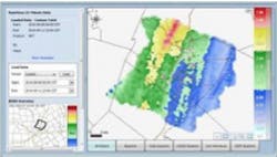
Austin, an NPDES Phase I community, invested in RainVieux and Vflo technology in 2004 to develop and manage its Flood Early Warning System by obtaining more accurate information about the region’s rainfall patterns. RainVieux uses both radar data and rain gauge data to provide more accurate rainfall estimates, and that information can be input into the distributed hydrological model Vflo.
“It’s extremely useful from a modeling perspective,” says Janek. “We have hazard areas in Austin. We have known in the past about areas in Austin neighborhoods that will need to be evacuated due to flooding, and there’s not a lot of time to mobilize forces to get people out. Investing in this technology helps provide us with the time tool to make us better forecasters and be more responsive first responders.”
This geographic information system technology merges Doppler information with that from the gauge network and re-aggregates it over a square kilometer, creating hydrographs.
Whether you’re monitoring your drains, warning neighborhoods of impending floods or engaging in any number of critical stormwater management tasks, GIS software can make it easier, more effective and less costly. Here’s a quick overview of the most popular products on the market today.
Aquatic Informatics Aquarius Software
Aquarius Workstation is more than just your traditional GIS software. Coupled with Aquarius Server, it’s a complete data management platform with a web-based user interface called Springboard that gives users access to their data anywhere, anytime. Aquarius Workstation streamlines the collection, storage, and grading of data, which enables users to process data efficiently. Workstation also allows users the same methodologies and tools as the US Geological Survey and Water Survey Canada, as well as import data from a wide variety of external databases (http://aquaticinformatics.com/products).
Esri ArcGIS Software
Esri’s GIS software, the ArcGIS platform, “brings together maps, apps, data, and people to make smarter decisions and enable innovation in your organization or community. It is a practical way to link science with action and is used by governments, industries, NGOs, and Fortune 500 companies around the world.” (From company website, http://www.esri.com/software/arcgis)
Hydra modeling Software by Pizer
HDRLink was created to be a software link between ArcView GIS and Hydra modeling geographic information system software. Environmental Systems Research Institute of Redlands, CA, produces ArcInfo and ArcView software. Hydra, developed by Pizer Inc. in Seattle, WA, is commercially available hydrologic and hydraulic software that is similar to SWMM (www.pizer.com/gis.html).
IBM Maximo Spatial Management Software
This solution integrates Esri’s ArcGIS and Maximo to geospatially view service calls from customer service and dispatch centers, as well as for managing preventative maintenance work and assets (www-03.ibm.com/software/products/en/maxispatassemana).
Mapistry GIS Mapping Software
Customers can create stormwater system maps and site plans in minutes, not hours, with Mapistry’s easy-to-use mapping tool. Mapistry is designed for scientists, engineers, and contractors who do not have the time to learn complex GIS mapping software. Maps are always available on Mapistry’s cloud platform whether on a construction site or at the desk. Mapistry provides the tools for customers to collect data in the field, build maps, and keep projects on track. (www.mapistry.com)
RainVieux software
“What is RainVieux? An interactive webpage is at the heart of RainVieux that allows the user to display, query, and download rainfall in near real-time products and end-of-month archival quality data. RainVieux provides quality-controlled rainfall data for municipal, private, and regional organizations basin-specific applications including watershed management, infiltration and inflow analysis, long-term capacity planning, and flood event analysis.” (From company website: www.vieuxinc.com/rainvieux.html)
StormCAD Software by Bentley
“StormCAD can run on one of four different platforms: stand-alone, MicroStation, PowerCivil for North America, or AutoCAD. Regardless of the platform used, StormCAD maintains a single set of modeling files for true interoperability across platforms. StormCAD’s stand-alone, MicroStation, PowerCivil for North America, and AutoCAD platforms offer unique platform freedom and versatility.” (From company website: www.bentley.com/en-US/Products/StormCAD/)
XP Solutions Software
XPSWMM, from XP Software, is a software package for modeling stormwater and wastewater flows. “xpswmm is a comprehensive software package for dynamic modeling of stormwater, river systems, floodplains and sanitary or combined systems. It combines one-dimensional (1D) calculations for upstream to downstream flow with two-dimensional (2D) overland flow calculations so that you can see what truly happens to your stormwater or sewer system when waters flow, populations increase or catastrophic events hit.” (From company website: http://xpsolutions.com/Software/XPSWMM/)
When it comes to geographic information system (GIS) products, there are plenty of options available for stormwater managers to consider in capturing, storing, manipulating, analyzing, managing, and presenting all types of spatial or geographical data required for effective stormwater management. GIS software and GIS mapping software are critical to any stormwater management program, and enhance municipal systems in many ways. For example, the city of Watchung, FL has been able to streamline its stormwater operations through the use of VUEWorks Storm, an integrated GIS asset and work management software tool. Storm interfaces with VUEWorks Core to provide asset management for storm drain systems. For example, flow arrows assist emergency crews in intercepting a contaminated spill before it reaches sensitive areas. The GIS software can also assist with tracking stormwater quality in pipes, managing watershed master plans, and planning for capital improvement projects. Then there’s Austin, TX, knowns as “flash flood alley” for a reason. Mitigating those flooding problems was a major impetus for adopting a Vieux GIS software system, according to Susan Janek, a city engineer. Vieux provides products for rainfall monitoring as well as for hydrologic modeling and analysis. Austin, an NPDES Phase I community, invested in RainVieux and Vflo technology in 2004 to develop and manage its Flood Early Warning System by obtaining more accurate information about the region’s rainfall patterns. RainVieux uses both radar data and rain gauge data to provide more accurate rainfall estimates, and that information can be input into the distributed hydrological model Vflo. “It’s extremely useful from a modeling perspective,” says Janek. “We have hazard areas in Austin. We have known in the past about areas in Austin neighborhoods that will need to be evacuated due to flooding, and there’s not a lot of time to mobilize forces to get people out. Investing in this technology helps provide us with the time tool to make us better forecasters and be more responsive first responders.” This geographic information system technology merges Doppler information with that from the gauge network and re-aggregates it over a square kilometer, creating hydrographs. Whether you’re monitoring your drains, warning neighborhoods of impending floods or engaging in any number of critical stormwater management tasks, GIS software can make it easier, more effective and less costly. Here’s a quick overview of the most popular products on the market today. Aquatic Informatics Aquarius SoftwareThis solution integrates Esri’s ArcGIS and Maximo to geospatially view service calls from customer service and dispatch centers, as well as for managing preventative maintenance work and assets (www-03.ibm.com/software/products/en/maxispatassemana). Mapistry GIS Mapping Software
XPSWMM, from XP Software, is a software package for modeling stormwater and wastewater flows. “xpswmm is a comprehensive software package for dynamic modeling of stormwater, river systems, floodplains and sanitary or combined systems. It combines one-dimensional (1D) calculations for upstream to downstream flow with two-dimensional (2D) overland flow calculations so that you can see what truly happens to your stormwater or sewer system when waters flow, populations increase or catastrophic events hit.” (From company website: http://xpsolutions.com/Software/XPSWMM/) [text_ad]


