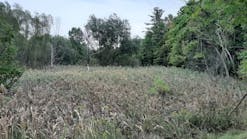
Lakes are jewels of the landscape. We are drawn to their shifting beauty and consider ourselves lucky to live close to their rustling shores. We take for granted many benefits that accrue from management of lakes’ water levels: electricity, irrigation, domestic water, visual splendor, and recreation. Yet unintended shoreline erosion often results when we simplify or armor shorelines to protect built environments at the water’s edge or when water levels are raised or lowered to increase the benefits of water management. When such changes result in chronic shoreline erosion, lake water quality, habitats, and benefits can suffer. Smart development can allow people to live, work, and recreate near the water’s edge without accelerating the rate of natural shoreline erosion.
To most of us, lakes are permanent features of enduring landscapes. Yet in the grand scheme of landscape evolution, lakes are an accident of drainage, present on the earth’s dynamic skin for a mere blink in geologic time. Sooner than later, lakes will evaporate, be drained by erosion of their outlets, or be filled with decaying plants or with dust, pollen, and sediments carried to them by wind, ice, or water. Some filled lakes will persist for a time as meadows, but eventually the meadow fill too will be lost to erosion. In fact, lakes change relatively quickly, and shoreline erosion is an important process that contributes to this change. The challenge for lake managers is to identify what shoreline processes are normal, how human activities influence shoreline changes, the rate of those changes, and what measures can be taken to protect the dynamic equilibrium of shorelines.
These questions become more pressing as populations boom, the need for clean water grows, and decisions about land and water management are increasingly affected by concerns about water quality and endangered species. The answers are complex, for the relations between shoreline conditions and the chemical and biological conditions of lakes involve many interacting variables, many of which might be changing seasonally or be influenced by disturbances or conditions in tributary watersheds.
Lakes’ etiology and morphology are related to the climate, the tectonic and surficial processes that formed them, and the materials of their basins (see the table). Therefore, the perspective of geoscience can be useful in sorting out the physical factors involved in the interplay of lake conditions. A physical geologist, a geomorphologist, or a physical geographer can interpret lakes’ geologic origins from topographic maps to assist lake managers in understanding the background conditions of particular lakes and anticipate the nature of physical changes expected to occur.
Signatures of Changing Landscapes
And change is certain, for lakes are formed in landscapes of change. In uplands, lakes are an expression of youthful drainage systems in which rivers have not yet worn their bounding interfluves back to well-drained, maximum relief. Lakes are frequent in the high latitudes and higher elevations, where they commonly occupy rock basins scoured out by alpine or continental glaciation, or are held by the rock detritus of glaciers. Lakes can be formed by the damming effects of dynamic mass-wastage events such as landslides or alluvial-fan floods. They may form as a result of crustal movements that cause warps or faults that interrupt the flow of streams from higher elevations to lower.
In the floodplains of low-gradient alluvial streams, natural river levees might prevent small tributaries from entering the mainstem. River-margin lakes can develop in such locations, which are often also indicated by the presence of small, tightly meandering “yazoo” streams running parallel to the major stream. Along coastlines, strand lakes may form where barrier bars, spits, or dunes drown river mouths and cut off the flow of rivers to the sea.
Obliterated by Streams
In their steady labor of grinding down the landscape, streams work to obliterate lakes by erosion, transportation, and deposition. As interfluves are undercut by stream erosion, earth material falls into the channel, where it is abraded, sorted, and transported. Rock that skids and bounces along as bedload further erodes the channel itself. All of this action breaks bedrock into boulders, boulders into cobbles, cobbles into gravel, and gravel into sand. A significant amount of rock material in some regions is broken down chemically and transported to lakes in solution. Through evaporation, chemical precipitation, and other processes that take place in lakes, a range of sedimentary rocks can form from such solutions, gradually contributing to the infilling of lakes.
Streams transport the coarse sediments along the channel bottom and in suspension. But when the coarse sediment load gets to the lake, the trip is over. The heaviest sediments drop out where the stream enters the quiet waters of the lake and loses both the velocity and power to carry them. The finer sediments settle out farther and farther away from the river mouth, until only the very finest colloids are left in suspension in the gently moving lake waters. Some might never settle but remain suspended by the motion of the water.
The Work of Wind and Waves
Many factors influence the movement of water in lakes and the erosion of lakeshores. In large lakes, the pull of the moon creates tides. Changes in atmospheric pressure produce changes in water surface levels. The currents of inflowing rivers can affect lake circulation. The temperature differential between the surface of the lake and water at depth is instrumental in lake turnover. Earthquakes, landslides, and subaerial or subaqueous slumping can generate seiches capable of unleashing tremendous, short-lived wave energy on shorelines. But the most common agent of waves is the wind, and the most important factor in determining waves’ height is fetch, or the unobstructed distance over which wind can travel in a straight line on the lake surface. Therefore, large lakes with their long axes parallel to the wind have the greatest potential to develop large waves.
Waves are waves, whether in fresh or salt water, and the physics, processes, and results of waves on lakeshores are similar to those of waves on sea coasts. Waves both erode shorelines and sustain them, so where lake beaches are present, they represent shore-zone dynamics in relative equilibrium. Therefore, lakeshore beaches are delicate treasures to be guarded.
Of all of the processes that can be interrupted by human works along lakeshores, arrest of longshore drift might be the most difficult for people to foresee and the most significant in its eventual impact. To most of us, a beach seems permanent. We don’t stop to wonder if the sand is aeolian in origin, a relict from a former climatic regime, if it is being supplied by an upshore river, or if it was created by the action of ice or waves along the shore. But, in fact, wind and waves are imperceptibly moving individual sand grains downdrift and replenishing them from upshore. This is the most simple and profound process of shoreline dynamics, and our understanding of this is essential to successful shore-zone management.
When waves break in the shallow shore zone and run up the beach, they lose their energy as they tumble forward. As they slide back down the beach, they drag a little sand with them and build a subaqueous terrace of sand. Thus, the beach is composed of sand in both the backbeach area and the shallow water zone near shore. On rocky shores, the work of waves actually cuts a notch and platform in the bedrock. The platform becomes veneered with sand on the foreshore, which extends offshore as a wave-built sand terrace. Longshore drift supplies ever-new sand while swash and backswash maintain the balance of the beach.
Cultural Impacts in the Shore Zone
Several anthropogenic forces that can upset this balance are the creation of continuous hard surfaces, such as retaining walls in the wave zone, and artificially raising or lowering the lake level. The decision to install retaining walls usually centers on the need to protect an important investment from the reach of wave erosion. But after the sea wall is installed, breaking waves can no longer burn up their energy in the forward-tumbling waves. Instead, they crash against the wall, and the residual energy in the backswash carries away everything it still has competence to carry: the beach sand. Within several years, the beach might be gone, the wall is undermined, and-because longshore drift has been intensified and sped up-neighboring properties downdrift might begin to experience new beach erosion.
The effects of water-level manipulation can also starve lakeside beaches. As a general rule, waves move sand onshore in summer. If we stand in the shallows of a lakeside beach in summer and study the minute movements of sand in the ripple marks at our feet (while enjoying the fragile gold nets of ripple shadows dancing over them), we can see sand trickling toward the beach over each tiny underwater dune as the wavelets nudge shoreward. In winter, storm waves will move the sand offshore, where it will remain in subsurface bars until the gentle, persistent energy of summer wave regimes can move it back onshore again. If the water level is dropped for the winter, the higher-energy winter waves can move the terrace sands to offshore depths that might be inaccessible to summer waves when the water level is raised again.
When lake levels are artificially increased, as when lake outlets are raised to increase water storage, shoreline processes must begin anew to create equilibrium at the water’s new edge. The sand of drowned beaches might be too deep to be carried ashore. It can take centuries or more for shoreline processes to create sandy beaches again. But first, the constant agitation of water at the new lake edge will steadily winnow soil from rock, releasing the soil’s organics, sediments, minerals, and nutrients to the lake. Unforeseen water-quality problems might ensue.
When the water level is seasonally lowered on a created lake where deep soils are present along a young shore, a series of chronic erosion processes may be set in place. During lake lowering, the pressure differential between the atmosphere and the soil interstices may generate soil loss through piping. As the lake level drops, the roots of moisture-loving vegetation at the lake edge might end up perched above the water table, and these plants lose vigor or die. The loss of root structure to hold the exposed banks leaves them vulnerable to wave erosion. The action of waves on the banks can undercut them, which results in calving or toppling of the undercut soils. Finally, depending on its composition, the exposed soil might shrink and crack as it dries, and the outer edges of the soil might drop off in plates or chunks. Finally, if the lake is shallow, waves may have the capacity to stir up bottom sediments, affecting water quality in the lake itself as well as downstream water resources. These processes will operate with every drawdown in a complex cycle of chronic shoreline erosion.
Integrated Solutions
Every lake troubleshooting team should include a person knowledgeable about the geomorphic processes that contribute to shoreline and lake conditions. To solve shoreline erosion problems on a site-by-site basis, careful analysis is required to ensure that longshore drift is not impeded, that wave energy is not amplified by the treatment, that downdrift properties are not degraded by upshore treatments, and that shore-zone processes can operate at expected magnitudes for diurnal, seasonal, annual, and periodic events. Coastal engineering has made many recent advances with respect to these considerations.
When lake turbidity is a concern, one of the first questions to ask is: What is the origin of the materials in suspension? Before a program is put in place to address the turbidity, monitoring should provide an answer to this question that is crystal clear. Many a lake manager have been startled to learn that increased turbidity is not the result of suspended sediments, as assumed, but of algae. Similarly, a problem of suspended fine colloids should not be assumed to be the result of such disturbances as logging or mining in tributary watersheds when it might, in fact, be the result of erosion processes set into motion by manipulation of the water level.
At a lakewide scale, a community-level effort is almost always needed to arrive at lasting solutions to widespread problems associated with shoreline armoring and lake-level manipulation. Effective problem-solving will require that lake managers, shoreline residents, and governments participate in a discovery and solution-building process. A technical team composed of both physical and biological scientists should be appointed to support the effort. By working together, cross-education takes place about the processes responsible for the problems as well as the potential solutions. The most successful and cost-effective solution will be the one that addresses the entire range of forces acting upon the shoreline and that considers avoided costs in addition to the long-term costs of alternatives.
Some of the most exciting solutions are being developed by local, regional, and state governments in the form of shore-zone codes, ordinances, and development standards. This pioneering work is being done in such places as Lake Tahoe, where there is political will and funding resources to protect a water resource recognized as a national treasure. Other states and municipalities are working on marine, stream, and shoreline protection instruments whose creation has been spurred by the National Marine Fisheries Service’s listing of cold-water and anadromous fish species, or by the requirements of the Clean Water Act. These efforts are ushering in a refreshing new era of preventative, administrative best management practices (BMPs) that have been a long time coming. At their heart is the recognition that shoreline processes are dynamic and must be protected to ensure protection of the ecological functions shores provide, including water-quality protection, beach nourishment, and maintenance of aquatic and littoral habitats.
The tools of these brave new BMPs are master planning, zoning, plan review, required setbacks and vegetative buffers, limitations on hard and impervious surfaces, and requirements for restoration of the undisturbed zone at the dynamic interface between the backshore and the foreshore. They hold tremendous promise for sustainable lakeside development. When these practices guide the location and nature of built environments in shore zones, planners are finding that they are effectual and cost-effective means of preventing human works from accelerating the rate of erosion at lakes’ dynamic edges.


