After a wildfire, the topography and the hydrologic response of a burn area often change. Without vegetation providing stabilization and cover, soil and rock material are exposed to wind and other erosive forces. Changes in soil porosity, either from surface sealing by ash and other fine sediments or by becoming hydrophobic (water repellent), can affect the ability to absorb water and contribute to flash floods and debris flows during storm events. Knowledge of these processes provides a better understanding of the risks to communities downslope of wildfire burn-areas during rainstorms.
Robert Leeper is a geologist and an unmanned aerial systems (UAS) pilot for the geotechnical and environmental engineering firm Haley & Aldrich (H&A). His interest is in post-burn areas and the interaction between rainfall and the freshly exposed sediments on the earth’s surface—how the geography and the geomorphology are changed as a result of water flowing over a burn area. “The hydrology affects the geomorphology and controls a lot of the processes that shape the surface,” he says.
In order to understand and model those changes, and as part of his Ph.D. work and innovative technology research with H&A, Leeper flies an unmanned aerial vehicle (UAV)—or drone—equipped with a high-definition camera and a GPS over a burn area. The data he gathers with the camera on the drone is then used to create a high-resolution 3D model of the burn area, which can be used to help anticipate where water and debris may flow during rainstorms. Because the fire creates a barren surface, it is possible to image and model fine topographic details of the ground with the drone to help better inform BMP placement prior to first rainfall. The UAV data-collection process can be repeated following subsequent rainstorms and updates to BMPs can be made based on the updated models if necessary, before the next rain event
As part of his ongoing Ph.D. research at UC Riverside, Leeper is conducting a study of post-wildfire hydrologic response in a burned watershed of the San Gabriel Mountains in Southern California following the 2016 Fish Fire. The Fish Fire was responsible for burning 4,253 acres of the combined 5,399-acre San Gabriel Complex Fire.
Using UAS—which include the GPS, software, sensors, and drones—Leeper has created multiple models of a portion of the Fish Fire burn area: one before the first rain event and one after each subsequent rain event. Leeper made a baseline survey and then returned after every rainstorm to gather more data with the drone. Between that first flight and the last rain event on February 18, 2017, he conducted 10 flights.
The models made with the data show “a theoretical flow of a drop of water on that surface, based on each of the data points in that model. So, it says it’s going to flow this way based on the slope, roughness, the elevation, and a multitude of other factors that can change as a result of the hydrologic response in the watershed during the previous storm,” he says.
The area Leeper examined was approximately 50 acres of the total burn area, in a steep headwater basin uphill from Duarte, CA.
“You could theoretically do this for multiple watersheds along this wildland-urban interface. This is just a small portion of [the burn area for this fire], but this is the portion of the watershed that affects the communities below it,” he says. “We are not as concerned for the other side of the ridge, as that area drains into a big natural channel that’s undeveloped. This is where it’s important, this is where we want to try to better understand where things are going to flow.”
The area he examined had a debris detention basin between the slope and the community, but he points out that “there are a lot of locations below burn areas that don’t have debris retention basins, so the flow just kind of goes into the community.”
Leeper became involved in flying UAS as part of his Ph.D. at UC Riverside. “My advisor there, Dr. Nicolas Barth, is on the cutting edge of remote sensing with drones and Structure-from-Motion (SfM). I had a lot of post-fire erosion experience from my time with the US Geological Survey, and we thought this would be a great opportunity to put the two together and see what we can do to detect finer scale change to better understand these processes,” he says.
Leeper has a Federal Aviation Administration (FAA) Remote Pilot Certificate and there are FAA rules and regulations for operating the drone. The pilot must maintain a visual line of sight with the drone, for one. The drone also cannot be flown over humans or at night and may only reach a maximum elevation of 400 feet above whatever is being imaged.
The camera attached to the drone(which Leeper tries to fly at a consistent 100 feet above the ground) takes 2D photographs of the burn area. These can then be used to estimate the 3D topography of the burn area through a technique called SfM photogrammetry.
“You can do automated flights or manual flights,” explains Leeper. “The manual flights require you to set the camera and keep it at a certain angle, depending on what your desired output is, and then, because there’s a known focal length and a handful of other known parameters, through triangulation and parallax you can reconstruct the shape and form of a surface to create a 3D model of it. Because as you’re moving the drone collecting the images to a slightly different position for each one, you start to see behind or beneath whatever may have been blocking something from the other position, and that’s where the term ‘Structure-from-Motion,’ or SfM, comes from.”
This method of 3D modeling and mapping can create high-definition digital elevation models capable of detecting centimeter-scale changes. “It depends,” says Leeper, “but typically what you can get from photogrammetry is one to two centimeters of resolution. People commonly work with one-meter and five-meter data sets—because that’s the maximum resolution they can achieve or have access to, but if you are using that level of resolution you can’t detect changes beneath that resolution [threshold].”
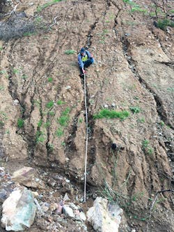
Without a drone, post-fire burn scar surveys are typically done in a “boots on the ground” fashion. A human surveyor with a tape measure must go out into the field and take measurements of the profiles of each channel and a plethora of other hydrologic and geomorphic measurements.
Leeper’s first drone survey was conducted after the fire but before the first rain event, on October 15, 2016. He says models made before a rain event help to anticipate where water and debris will likely flow, which allows time to prepare debris basins and install BMPs to protect communities or other resources downhill from the burn.
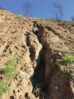
After each rain event, subtle to drastic changes in topography can occur, depending on rainfall intensity. Rills can become gullies or channels, and debris can cut off some streams completely and redirect flow paths. Runoff and debris during any subsequent rain event may flow in different directions than during the previous event. And there’s a unique feature of the Southern California Transverse Ranges, which includes the San Gabriel Mountains, that affects debris flows during a post-burn storm event.
“In southern California, the Transverse Ranges are dominated by a chaparral vegetation ecosystem that has organic compounds in it that, when they burn, can spontaneously combust—turn to gas,” says Leeper. “The gas can settle into the soil and when it cools, it turns into a waxy substance that is impermeable to water. So, once water reaches that hydrophobic layer in the soil, it can’t go anywhere but down the slope. It reduces infiltration and increases runoff; water that would normally go into the soil can’t and instead flows downslope across the surface.”
As that water flows downslope and increases in volume, it can entrain sediment, large or small. Leeper says that’s when you get sediment bulking and minor flows can turn into debris flows. That movement of soil and sediment changes the topography yet again.
“After each storm, you can go out [and survey again] and the model changes because that surface within the channel changes, which affects how the water flows,” says Leeper. Remember our boots on the ground human with the measuring stick? To do a second, post-flow survey without a UAS, that person would have to hike back out to the burn area and make a new set of observations and measurements.
Because the models that are made from the data gathered with the UAS are so detailed, “they may pick up on something that somebody may miss in the field,” says Leeper.
However, he’s quick to point out that he’s not advocating removing the human element entirely. “I’m not saying [do] this without any boots on the ground—you can’t take that component away. You need that trained eye, you need somebody who understands hydrologic and geomorphic processes, how things flow.” But there are advantages to creating models and conducting surveys with UAS.
First of all, using a drone is safer. Post-burn areas are hazardous environments; there’s dust and ash and unstable soils, even after a rain event. From a health and safety perspective, the fewer people sent into the field, and the less time they spend there, the better.
It’s also faster. Leeper estimates that just flying the drone around the steep 50 acre area he surveyed for the model took him 35 or 40 minutes, although he did hike into the watershed to take photos, ground-truth the model results, and make some measurements, all of which he says would have to be done during field reconnaissance whether or not he’d used a UAS.
The drone can also gather more data than a solely boots-on-the-ground survey could. The models Leeper created are on the centimeter scale, as opposed to the meter scale that he says many people are used to.
The UAS data do more than just create finer resolution models though, says Leeper. “You can pair the UAS data—this topographic change and analysis from the UAS imagery—with hydrologic monitoring techniques like rain gauges, and pressure transducers,” he says. “Post-fire hydrologic monitoring is something that the USGS has been doing for years and I participated in when I worked for them. Pairing the UAS technology with hydrologic monitoring techniques really helps you characterize the multiple processes that contribute to hazardous debris flows and flash floods; it helps you understand the processes and mechanisms. Because of a long history of amazing post-fire erosion research done by scientists, we know that certain intensities of rainfall for a certain amount of time triggers flash floods and debris flows, and this is used in hazard response planning and warnings.”
Leeper says that for people who install the BMPs, the software makes it easy and quick to make linear measurements, allowing faster response times after a burn. “You can know that you need 150 feet of fiber rolls here or 250 feet of K-rail there, and you can make these measurements rapidly in the software instead of having someone go out and manually measure everything,” he says. “That all plays into the rapid response that a community could utilize. Instead of spending a day (or multiple days) having someone go out and measure it, it can be done once the model is completed in the software in a couple of minutes.”
While some are using drones in the construction industry for surveying and monitoring, Leeper doesn’t know of anyone else using them to create high-definition digital elevation models and to track changes and increase BMP effectiveness on a storm-by-storm basis. He’s hopeful that more communities and organizations may start to utilize the technology.
“It’s a data set that you can rapidly acquire that helps inform your decisions on the ground,” he says. In California, the onset of the rainy season marks the end of the fire season. Since rain events can follow a wildfire within a matter of days or weeks, rapid response is vital. Leeper believes UAS 3D mapping and modeling can provide the data communities need to react quickly after a fire.
The technology is incredible,” he says. “It’s amazing what you can do from the photos. I think it’s just awesome and that’s why I love it. It ties together my passion for understanding natural processes and hazards, plus it’s super cool, useful, and helps people.”
Rachel Sim | Editor
As the editor of Stormwater magazine from June 2019 to December 2020, Rachel Sim created and curated quality content addressing the challenges faced by surface water and erosion control professionals, focusing on cutting-edge technology and the latest environmental research.

