The most common image of Las Vegas is probably that of its Strip of hotels and casinos. They are the reason the city is known as “The Entertainment Capital of the World.”
But there is another part of Las Vegas, as significant to the city and its economy as the Strip, that most tourists don’t see. It has its own title: “Oasis in the Desert.”
The proper name for this essential part of the city and surrounding communities is the Las Vegas Wash. This 12-mile channel is the primary conduit for water to and from Lake Mead. The wash accounts for about 2% of the water volume of Lake Mead, which is the source of drinking water for Las Vegas.
The excess water that the Las Vegas Wash returns to the lake comes from four sources: urban runoff, shallow groundwater, stormwater, and releases from four water reclamation facilities located in the Las Vegas Valley. Average excess water flow is more than 150 million gallons per day.
The Clark County Wetlands Park is the final drainage point. It receives primarily wastewater effluent, about 90%. Stormwater accounts for about 4% of the water that goes through the wetlands park.
Native Americans lived adjacent to the wash, valuing it for its more than 2,000 acres of wetlands. The Las Vegas Wash was truly an oasis in the desert for pioneers traveling westward. Its presence led to the founding of Las Vegas and surrounding communities.
However, as the city of Las Vegas and other nearby communities were developed, the wetlands were gradually reduced. Now they total a little more than 200 acres of the 2,900-acre park.
“The wash is pretty shallow, about seven to 10 feet deep. It’s a perennial stream, about 40 to 50 feet wide,” says John Tennert, environmental mitigation manager for the Clark County Regional Flood Control District (CCRFCD).
In 1998, the Southern Nevada Water Authority joined with more than two dozen local, state, and federal agencies, the University of Nevada at Las Vegas, and other groups to form the Las Vegas Wash Coordination Committee. Its purpose is to protect and enhance the wash and its surrounding wetlands.
Tennert says that as flow from storms increases, it causes heavy erosion in the channels leading to the wash. Hundreds of millions of dollars have been spent to stop the erosion.
Erin Neff, CCRFCD’s public information manager, notes that flow rates in the wash vary. “We measure cubic feet per second passing the last gauge before the lake. Rough flow rate on a normal day is 250 cubic feet per second at that point, and it’s estimated to be 16,000 cubic feet per second for big storms.”
The Southern Nevada Water Authority has installed a series off 22 erosion control weirs, ranging from 10 to 15 feet deep and measuring up to 100 feet in width. Other long-term protection strategies include continued streambank stabilization, managing invasive plant species, and revegetating the land with native plants.
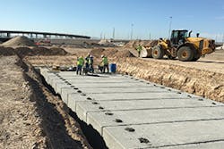
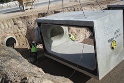
Culvert installation under the Centennial Bowl
A History of Flooding
Because of the scarcity of rain combined with the intensity of the storms that the Las Vegas Valley receives, stormwater management is intertwined with flood control in the region. The valley has a history of flooding; the US Soil Conservation Service documented 184 flooding events there from 1905 to 1975.
Since 1960, eight floods have occurred that caused $1 million or more in damages. Twenty-five people died during those floods. In July 1999 torrential rains caused widespread street flooding in local communities. Two people died and property damages totaled more than $20 million.
“Our biggest challenge is the highly intensive and sporadic nature of storms. We get roughly 4.2 inches of annual rainfall, in six to 11 storm events a year,” explains Tennert.
The limited amount of rain and infrequency of storms—especially when considered together—suggest that stormwater and flooding don’t cause many problems. Members of the public tend to forget about rain, and most visitors to Las Vegas never see it.
“It’s hard to justify implementing stormwater measures when it’s a long time between storms,” he says. “We’ve gone over two months now without rain.” But when the Las Vegas Valley gets a storm, it’s usually fast and hard. The monsoon season is in July and August, sometimes lasting into September.
Topography plays a big role in how storms affect Las Vegas and surrounding communities. “We live in a big bowl. The whole Las Vegas Valley drains into the Las Vegas Wash that goes to Lake Mead,” says Tennert. CCRFCD’s goal is “keeping that water from going downstream. We have lots of flood control detention basins and flood control channels.”
Staff members at CCRFCD focus on regional management of stormwater and flood abatement. Of course, individual communities have their own specific projects to manage stormwater within their jurisdictions.
Although Las Vegas does not have a stormwater utility, “We have a stable source of revenue—one-quarter of each cent of sales tax [paid] in Clark County—and we also bond major projects,” says Neff.
One significant project that CCRFCD undertook involved the site of a golf club now called The Club at Sunrise. Formerly known as Desert Rose Golf Course, the site was overhauled to improve flood control in the surrounding area. “This area flooded terribly. The project was a big win for residents,” says Tennert.
“Just by widening the Upper Las Vegas Wash, we took 2,300 houses out of the flood zone,” says Neff. “Thousands of people no longer are required to buy flood insurance.”
Culvert installation under the Centennial Bowl
Besides peace of mind from worrying about potential flooding, these residents now have more money to invest in their properties for remodeling or maintenance. Those collective expenditures help stabilize the neighborhood.
“Before we did this project FEMA estimated that the area could hold 10,000 cubic feet of water. Now the capacity is 15,500,” says Neff.
“In the past year we’ve been going in and under streets in older developed areas to provide more flood control. We have worked with the DOT on this,” she adds.
One such massive traffic project was a flyover ramp where Interstate 215 connects to I-95. Known as the 215 Centennial Bowl, the project involved placing a massive reinforced concrete box culvert (32 feet by 10 feet) under the highway for one mile.
Neff says that CCRFCD’s stormwater and flood control projects are “generally a mixture of small drainage projects, some in rural areas and some in urban areas.” Traditional green infrastructure doesn’t play a major role in stormwater management, as rainfall is too scarce.
“We don’t have a lot of green infrastructure,” says Tennert. “Large parking lots are required to treat a certain amount of runoff.” Not surprisingly, “green roofs are not popular here. There’s not enough rainfall. Solar panels are very popular though.”
He notes, “There is a shallow aquifer in the valley created by over-irrigation. It releases selenium into the Las Vegas Wash, so we discourage infiltration [of stormwater runoff] because we don’t want to exacerbate the problem with selenium.”
Las Vegas Springs Preserve
“Our NPDES [National Pollutant Discharge Elimination System] program is a little bit different,” he says. “As the regional flood control district, we serve as the regional coordinating agency for the five permitees on the permit: Henderson, Las Vegas, North Las Vegas, Clark County, and the Regional Flood Control District.
“In 1990 we bonded together and, as the coordinating agency for the group, we stepped forward with money to support projects to address water quality associated with stormwater. Our biggest challenge is that many traditional BMPs don’t work here,” he says.
“A lot of our efforts, such as our detention basins, are pretty important to maintain water quality for sediment. These basins collect sediment and keep it from entering the Las Vegas Wash and Lake Mead.” Ninety-one of these detention basins are in place throughout Clark County. They average 8 to 9 feet deep. “The largest basins are in the foothills of the mountains,” Tennert says.
The Kyle Canyon Detention Basin is a mile long, 50 feet deep, and 300 feet across. Even with its massive capacity, this detention basin overflowed during flash flooding in 2013. A wildfire had burned 28,000 acres in the Spring Mountains. When major storms hit, water, sediment, and debris flowed down into the surrounding northwest Las Vegas neighborhood. In 2015, the Kyle Canyon Detention Basin was upgraded. Its $17 million retrofit connected the basin to underground channels that would handle a greater volume of water.
Bridge at Centennial Hills Park
“One thing our permit requires is that we construct water-quality features in some of these detention basins. We’re required to treat up to a two-year storm, so we installed weirs within the detention basins to capture sediment and pollution. We regularly clean the detention basins of sediment,” explains Tennert.
“We implement standard BMPs on construction sites. That’s done on the ground by the different municipalities. We have a constant inspection program. The focus is really education and compliance. Of course we do issue fines when we have to. As stormwater becomes a bigger issue from the regulatory standpoint, our requirements increase. Our permits never go backward. The requirements only get stronger.”
He adds, “We have a good working relationship with the regulatory community. Periodically, once or twice a year, we have outreach training for contractors. We talk to them about NPDES, what the purpose is, what specific requirements on their part are. We talk to cement truck companies, roofers, any company involved in construction. You name it, we’ve done some kind of stormwater outreach with them.”
Tennert says that the Nevada Division of Environmental Protection is “a partner, rather than just a regulator. Our work with the state is really a collaborative effort.”
Neff says that in the next year or so, CCRFCD’s stormwater and flood control projects will be “mostly related to transportation, such as the US 95 interchange in the northwest portion of Las Vegas.” Stabilization efforts on the Las Vegas Wash will continue. Duck Creek, which drains into the wash, is also a planned project site.
Tennert notes, “Given the flows during storms, we really have to use hard armor for stream and channel stabilization.” He says soil in the Las Vegas Valley is “largely alluvial, with some sandy loam. There is very little absorption. Rainfall mostly runs off.”
Clark County Wetlands Park
Protecting the Strip, Tourists, and Locals
Neff says Las Vegas gets about 30 million visitors a year. “Most of them have no idea of flooding here.”
Describing a flood control project above the Las Vegas Strip, Neff says, “The Army Corps of Engineers spent $400 million on flood control. All of the basins and channels [installed] over a nine-year period have reduced flooding on the Strip.”
She notes that with natural washes existing in what is now an urban area, part of one hotel still sometimes turns into “a flood zone during a major storm, so the property closes down that area [completely].”
Some natural scenic areas around Las Vegas, such as Red Rock, are subject to flash flooding every summer. Signs are posted to warn hikers.
“We do have extensive public outreach,” says Neff. “We go into schools and talk to second and third graders, giving them age-appropriate information on how to stay safe during storms.”
CCRFCD has some partnerships with the county school district that involve older students, too. The agency has partnered with the University of Nevada Las Vegas for two studies on flood control.
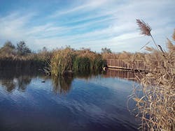
The Las Vegas Wash starts in the northwest part of the valley and drains to the southeast. The Lower Las Vegas Wash is the part that flows into the wetlands park. Bird species recorded in the park number 310, including many species of herons. Neff adds that more than 70 species of other animals live there too, including beavers. More than 200 species of upland, riparian, and wetland plants grow there; wetland plants flourish in the ponds created behind the weirs.
Tennant says the park is a great asset to the Las Vegas Valley. “The wetlands are all connected. There are hiking trails, paved bike trails, and bridges over the wash.”
Golf courses’ demands for water in locations where it is not abundant have drawn criticism on many fronts. “We’ve done a lot in the last 15 years in the region for conserving water use on golf courses,” says Tennert.
Notable Projects
Las Vegas Springs Preserve was created to preserve the history of the birthplace of the city. Since its opening in June 2007, more than two million visitors have toured this interesting and attractive site, which is owned by the Las Vegas Valley Water District.
“It’s about five miles from downtown Las Vegas,” says Jack Zunino, FASLA, PLA, president of JW Zunino Landscape Architecture. His firm created the final concept plan and construction drawings for various sections of the preserve.
Zunino calls the 320-acre site “a gem in the desert. When I have visitors to Las Vegas, that’s the first place I take them.”
The preserve has a 30 million-gallon reservoir and a working water well field. The wells pump to three different hydraulic zones. “They draw water from the aquifer in the summer and replenish the aquifer in the winter,” says Zunino.
He persuaded the Las Vegas Valley Water District to put a parking lot atop the reservoir area. Trees in pots are located on the roof, and photovoltaic cells shade the cars.
“They also collect onsite water,” he notes. “There is a dry riverbed that runs almost the length of the project. All site water goes into a contrived wetland that looks natural. It is a natural filtration system.”
He adds, “You can see where the water enters. The forbs and reeds are taller at the beginning of the system because they get more nutrients—or pollution—there.”
The water flows into tanks and is recirculated to irrigate the landscaping.
The name “Las Vegas” means “the meadows,” and Zunino notes that the Springs Preserve site was once called The Meadows. There was standing water there, so when the railroads ran steam engines the site was a stop for adding water before traveling on to either Los Angeles or Salt Lake City.
In earlier times, the Paiutes and other Native Americans lived there. Evidence shows that both the Mormon Trail and the Spanish Trail crossed through the location. The site’s first building has been made into a history museum for visitors.
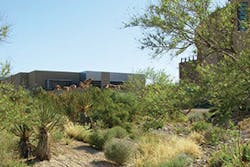
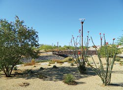
Thirteen groupings of indigenous plantings are arranged according to where the plants grow by elevation. Zunino explains that quail bush, Joshua trees or yucca, and creosote are among the plants that grow at lower altitudes. Pine trees grow at the higher points in the mountains.
“The site also has a detention basin. Flooding comes down an adjacent street, Alta. We put in an open trapezoidal channel under Alta so water flows down into the basin. We created a wetlands there also,” he explains.
The natural rock channel and the basin cover 10 acres. The basin is deep enough to contain islands. Groupings of native trees—honey mesquite, cottonwood, native ash, and a native (though not true) willow that grows near the wash—line the entry to the basin.
“The trees have grown up now. They shade the site and block traffic noise. You wouldn’t believe that you’re in an urban area,” he says.
Zunino says that his firm’s work on the Centennial Hills Park “required some special care for drainage. Las Vegas is still not used to design and development up in the foothills.” Instead of installing one big flat parking lot that would have allowed flooding from a major storm’s runoff, “we made several parking lots that follow the slopes—upper, middle, and lower parking lots,” he explains.
He is especially proud of the park’s play lot, which is the first one in the Las Vegas Valley with universal access. “Every slide, every swing, every section is rated ADA-accessible for kids.”
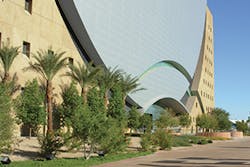
Another Zunino project is the World Market Center in downtown Las Vegas. The 57-acre site includes several large buildings in a highly urban setting. Although fire trucks have to have access to such a site, “instead of a typical asphalt, 20-foot-wide fire lane, we were able to make it look like a pedestrian corridor, not an industrial site. It has a large palo verde tree in front.”
The firm created landscaping around the various buildings. Some water is collected from the large central plaza area and saved for irrigation.
Zunino says that practicing landscape architecture in the Las Vegas Valley “is very challenging—how we do soil amendments, shading of sun in the summer, and so on. We live in a desert.”
He adds, “Our soils are almost impervious, so even a half inch of rain is a pretty big storm. We’ve been cognizant of that, so we try to do rain harvesting on any project we do.”
One way of including rainwater harvesting on projects is to add or to use existing dry river beds to funnel stormwater into a collecting basin at the lowest point on the property. Then the runoff can’t cause flooding and is available for irrigating plants.
“Instead of [installing] pipes to carry the water to the storm sewer system, we think it’s more important to use the water onsite,” Zunino says.
The Zunino firm’s office building, converted from a former residence, has a water harvesting river bed.
The trees and other vegetation—including native mesquite, Chilean mesquite, chokecherry, bear grass, lantana, and yucca—are irrigated by the rain collected. It’s convenient to show clients, along with demonstration gardens on the property.
Zunino says that using only native plants “limits our palette,” so he likes to include some nonnatives that have become adapted to the desert. For grass or turf he prefers a hybrid Bermuda that “repairs itself quickly” rather than regular Bermuda. He advocates having turf in areas where people play, but “not turf just to have turf. That’s the right thing to do.”
Scarce rain that falls in intense storms, soil that won’t infiltrate water, a hot desert climate, a location in a valley below foothills and mountains—all of these factors make stormwater management and flood control interconnected for Las Vegas and surrounding communities.
